Apparel Map Art Print & Signs Websites Retailers Blog Contact
That Dawg Blog
Hudson Valley town stories

Every town has a story.

The Hudson Valley is full of towers, trestles, ghosts, apples, strange skies, and people who turn local pride into something you can wear.

11 stories7 local stops1 valley
Sky Top Tower above New Paltz Rosendale Trestle Night sky over Pine Bush
The local story trail

Pick a place. Open the story.

A quick trail first. The full researched story opens only when you want it. Follow the landmarks, legends, bridges, farms, and shop stories that give each town its personality.

Sky Top Tower above New Paltz
Landmark6 min read The tower that always means home A stone North Star above the ridge, built to remember a life and adopted by an entire town. 1,542 feet upOpen the full storyClose story
BlogNew Paltz › HV History
🏔️ HV History · Town Spotlight

The Tower That Always Means Home

A stone North Star above the ridge, built to remember a life and adopted by an entire town.

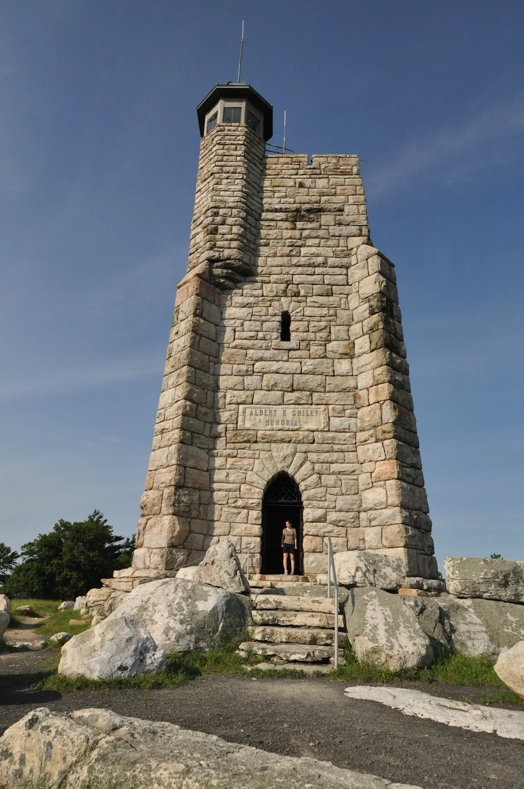
Sky Top Tower, Mohonk Preserve, New Paltz NY
Sky Top Tower · Shawangunk Ridge · New Paltz, NY · Est. 1923

Perched on the Shawangunk Ridge above New Paltz, Mohonk's Sky Top Tower is more than a stone structure on a mountain. For generations of local residents, it has been a fixed point in the landscape, something you look for instinctively when you return home from a long trip, the way a sailor looks for a lighthouse.

The tower is officially called the Albert K. Smiley Memorial Tower. It stands at 1,542 feet above sea level, built from Shawangunk conglomerate rock quarried directly from the mountaintop. On a clear day, the view from its 100 steps reaches across six states: New York, New Jersey, Pennsylvania, Connecticut, Massachusetts, and Vermont.

“For the residents of New Paltz, the tower is more than just a scenic overlook; it is an iconic landmark deeply embedded in the local identity, a ‘North Star’ or ‘beacon’ that signals home.”

Four Towers: A History of Perseverance

The stone tower you see today is actually the fourth observation structure to stand on what the Smiley family called “Sky Top”, a high point on the ridge originally known locally as Paltz Point. Each of the first three towers met an early end.

1870

Tower One: The Octagon

Alfred Smiley erected the first tower, an octagonal structure of hemlock and white pine, in the same year the Mohonk Mountain House opened. A severe windstorm destroyed it in February 1872, just months after completion.

1872

Tower Two: The Matched Pine

A second tower of matched pine, three stories tall. Alfred wrote to his brother that a violent storm struck during construction, “almost a hurricane”, but the tower held. It was destroyed by fire in May 1877.

1878

Tower Three: Seven Flights

Seven flights of stairs, four platforms, four floors. It stood for over three decades before being destroyed by fire on June 15, 1909.

1921–23

Tower Four: The Stone Memorial

Following the death of Albert Smiley in 1912, the family committed to building something permanent. Funded by 875 Mohonk guests and neighbors. Cornerstone laid August 8, 1921. Dedicated August 8, 1923.

Built to Last: The Stone Tower

In 1919, New York State proposed building a steel fire observation tower on the spot. The Smiley family objected and lobbied to build a stone structure instead. The design was overseen by architect Francis F. Allen of Allen and Collens. Bruce Smiley served as project manager. Stone mason John Lawrence and stone cutter Frank Lawrence shaped each block of Shawangunk conglomerate rock.

The quarrying process created a large cavity ingeniously converted into a 1.3-million-gallon reservoir, still used today. The tower served as an official forest fire lookout station until 1966.

By the Numbers
  • 1,542 feet: elevation above sea level
  • 60 feet tall: height of the stone tower
  • 100 steps: exactly, to reach the observation platform
  • 6 states: visible on a clear day: NY, NJ, PA, CT, MA, VT
  • 875 donors: guests and neighbors who funded the memorial
  • 1.3 million gallons: reservoir capacity carved from the quarry site
  • 6,400 acres: size of the surrounding Mohonk Preserve
  • 165,000: annual visitors to the Mohonk Preserve
  • 1986: designated a National Historic Landmark

The View From New Paltz

The tower's significance for New Paltz residents goes beyond its history. Visible from Main Street on a clear day, it appears on the western horizon as a small but unmistakable silhouette. The name “Mohonk” may derive from the Lenape word maxkwung, meaning “hill of bears.” The Smiley brothers purchased the land in 1869 from local farmers who considered the steep, rocky terrain essentially worthless, paying roughly $10 an acre.

Where to See It

  • River to Ridge Trail: connects New Paltz to the Shawangunk Ridge through farm fields with frequent tower views
  • Butterville Road: open views toward the ridge, especially in early morning
  • Main Street, New Paltz: visible from town on clear days, framed by the ridgeline
  • Duck Pond Trailhead (Mohonk Preserve), the 6-mile Skytop Loop leads directly to the tower
  • Sky Top Trail: 1.6-mile moderate loop, 288 ft elevation gain, ~45 minutes. Exactly 100 steps to the top.

A Living Institution

The Smiley family has stewarded Mohonk for over 150 years, five generations. In 2023, the tower celebrated its 100th anniversary. The family has maintained over 112 years of daily weather and environmental data from the mountaintop, one of the most valuable long-term climate records in the northeastern United States.

When you wear a That Dawg Local New Paltz design, you're wearing a piece of that landscape. The ridge. The view. The tower on the hill that people have been looking up at since 1870.

Sources and further reading
  1. “New Paltz's iconic Sky Top tower turns 100.” Hudson Valley One, Oct. 2023. hudsonvalleyone.com
  2. “The Story of Sky Top: A Towering Achievement.” AboutTown. abouttown.us
  3. “Skytop Tower Trail.” Outdoor Project. outdoorproject.com
  4. “Sky Top Trail.” AllTrails. alltrails.com
  5. “Trailheads.” Mohonk Preserve. mohonkpreserve.org
  6. The Enduring Sentinel: Mohonk's Sky Top Tower. Source document provided.
↑ Back to top
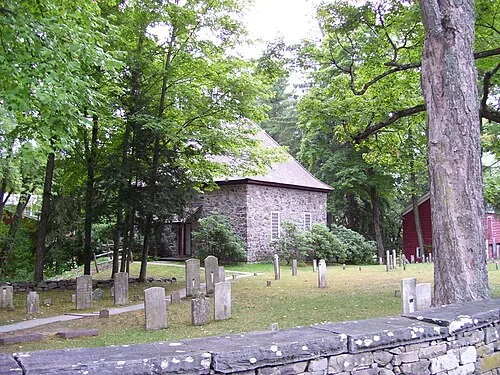
Historic cemetery on Huguenot Street
Local lore5 min read Ghost stories on Huguenot Street Old stone houses, river mist, family legends, and the stories that refuse to leave the street. 340+ yearsOpen the full storyClose story
BlogNew Paltz › HV History
👻 HV History · Ghost Lore

Ghost Stories on Huguenot Street

Old stone houses, river mist, and the local legends that refuse to leave the street.

Cemetery and 1717 Reformed Church, Huguenot Street
Cemetery & 1717 Reformed Church · Huguenot Street · New Paltz, NY

Walk Huguenot Street after dark and the familiar street changes. The stone houses absorb the last light. The Wallkill moves quietly nearby. In the old burying ground, markers worn smooth by three centuries seem to disappear into the grass. Local legend says that somewhere near the Deyo House, a woman in white still walks.

The setting is real. Historic Huguenot Street is a 10-acre National Historic Landmark District at the original center of New Paltz. The settlement was established in 1678 by twelve French Huguenot patentees, and its surviving stone houses date largely to the early 1700s. The hauntings are stories, not proven events, but many grew from local oral history, newspapers, diaries, and the difficult lives documented on the street.

The Stories in the Stone

The best-known legend belongs to the Deyo House. Visitors and storytellers describe a pale figure near the gardens at twilight, usually called the Woman in White. Other accounts place footsteps and a mourning presence inside the house. At the old burying ground, people have reported lights moving between the graves like lanterns carried by people no one can see.

👗

The Woman in White

A luminous figure associated with the Deyo House, usually seen near dusk. Her identity changes from one telling to the next.

🪔

The Phantom Lanterns

Flickering lights said to move through the old burying ground, where many of the founding families were laid to rest.

👣

The Empty Footsteps

Staff and visitors have described footsteps and small flashes of light inside houses that appear to be empty.

History With the Lights Turned Low

Historic Huguenot Street has explained that its haunted programs use archival material and documented fears as their starting point. That does not make every ghost claim a fact. It does make the stories more interesting. The legends reveal how people understood isolation, illness, grief, death, and family memory in a settlement where life could be harsh and private tragedy rarely disappeared completely.

The full history is heavier than a ghost tour. The Bevier-Elting House cellar once housed enslaved people. Joseph McGill of the Slave Dwelling Project later spent a night there as an act of remembrance. The land was home to the Esopus Munsee long before European settlement. These histories should not be turned into supernatural decoration, but they help explain why the street carries such emotional weight.

Why the Stories Survive

Huguenot Street is not a movie set or a reconstruction. The walls, floorboards, cellars, and burial ground are physically connected to generations of people who lived there. That continuity gives the imagination something solid to hold. Whether the lights are ghosts, reflections, or simply stories sharpened by darkness, the street makes the past feel unusually close.

Plan a Visit
  • Start at: DuBois Fort Visitor Center, 81 Huguenot Street, New Paltz
  • Look for: House tours, cemetery programs, and seasonal haunted events
  • Current details: Check huguenotstreet.org before visiting
Sources and further reading
  1. “Historic Huguenot Street.” National Historic Landmark District. huguenotstreet.org
  2. “Haunted Huguenot Street Walking Tour.” Historic Huguenot Street. huguenotstreet.org
  3. “NEWS RELEASE: Haunted Huguenot Street Expanded to Three Weeks.” huguenotstreet.org
  4. “NEWS RELEASE: Haunted Tours to Feature Lenape Legends and Modern Spiritualism.” Oct. 2017. huguenotstreet.org
  5. “Huguenot Street's Haunting History.” The New Paltz Oracle, Oct. 2013. oracle.newpaltz.edu
  6. “Horror, Hauntings and History.” The New Paltz Oracle, Nov. 2011. oracle.newpaltz.edu
  7. “Hauntings and History Meet at Huguenot Street.” The Little Rebellion, Oct. 2015. thelittlerebellion.com
  8. “Calendar of Events.” Historic Huguenot Street. huguenotstreet.org
  9. The Whispering Stones: Ghost Lore and Legends of Huguenot Street. Source document provided.
↑ Back to top
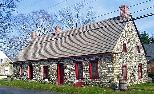
Historic stone house on Huguenot Street
Living history6 min read The street built in stone A rare neighborhood where the architecture, families, and complicated history are still in conversation. 12 founding familiesOpen the full storyClose story
BlogNew Paltz › HV History
🏗️ HV History · Architecture

The Street Built in Stone

A rare neighborhood where architecture, families, and complicated history are still in conversation.

Abraham Hasbrouck House, Huguenot Street, New Paltz NY
Abraham Hasbrouck House · Huguenot Street · New Paltz, NY · Built 1721

Most living-history museums rebuild the past. Huguenot Street does not have to. Its stone houses have stood in New Paltz for more than three centuries, still sitting along the same narrow street near the Wallkill River. That physical continuity is the reason the place feels different before a guide says a word.

The settlement began in 1678 with twelve patentees from seven French Huguenot families. They called themselves the Duzine, from the French word for dozen. The year before, family leaders had negotiated a large land agreement with Esopus people. The agreement and the colonial patent helped create New Paltz, but they also began a long process of displacement that cannot be separated from the town's founding story.

Wood First, Then Stone

The earliest homes were wooden. As families became more established, they rebuilt with local fieldstone and limestone. Thick walls, steep roofs, compact rooms, and massive fireplaces reflected Dutch building traditions as much as French ones. Tree-ring dating places both the Abraham Hasbrouck and Jean Hasbrouck houses in 1721, showing that the street developed over time rather than appearing all at once.

Each house records a different kind of change. The Jean Hasbrouck House preserves a rare jambless fireplace. The Deyo House began as a modest stone home and was dramatically expanded in the Queen Anne style in 1894. The DuBois Fort, built around 1705, now serves as the visitor center. Together, the buildings show families adapting their homes as their wealth, tastes, and circumstances changed.

The most interesting thing about Huguenot Street is not simply that it is old. It is that the same buildings kept changing while the community changed around them.

Who Built and Sustained the Street

For many years, public interpretation centered almost entirely on the patentees and their descendants. The surviving records tell a broader story. Enslaved African people helped build, farm, and maintain these households. Names including Jack, Betty, Garret, and James appear in family records, while many others were never recorded.

The site also stands on the ancestral homeland of the Esopus Munsee. Historic Huguenot Street now works with federally recognized Lenape-Delaware communities and local Black-history partners to bring those voices into the interpretation. That work matters because preservation is not only about keeping walls upright. It is also about deciding whose lives are remembered inside them.

A Street That Still Talks Back

The archives hold the 1677 land agreement, deed, and patent. The burying ground holds generations of residents. The houses contain original architectural details, furnishings, textiles, and evidence of both comfort and coercion. Visitors can walk through all of those layers in a few blocks.

That is what makes Huguenot Street feel alive. It does not offer one clean colonial story. It offers a preserved neighborhood where French refugees, Dutch neighbors, Esopus Munsee people, enslaved Africans, women managing estates, laborers, children, and later preservationists all left marks that can still be read.

Plan a Visit
  • Visitor center: 81 Huguenot Street, New Paltz
  • Best experience: Guided house tour plus time to walk the street and burying ground
  • Current tours: Check huguenotstreet.org
Sources and further reading
  1. “Dive Into the History of Historic Huguenot Street in New Paltz.” Hudson Valley Magazine, May 2023. hvmag.com
  2. “Our Houses.” Historic Huguenot Street. huguenotstreet.org
  3. “Huguenot Street Historic District.” Wikipedia. en.wikipedia.org
  4. “Historic Huguenot Street Tells the Full Story of Ulster County's Earliest Settlers.” Yahoo News / Hudson Valley coverage, Oct. 2025. yahoo.com
  5. “A Photographic Tour of Huguenot Street at New Paltz.” American Catskills, 2022. americancatskills.com
  6. “New Paltz Town Records (1677–1932).” Historic Huguenot Street. huguenotstreet.org
  7. “Crispell Family Association.” Historic Huguenot Street. huguenotstreet.org
  8. “Stone Houses in New Paltz.” Town of New Paltz (context study PDF). townofnewpaltz.org
  9. “About Our Town.” Town of New Paltz, NY. townofnewpaltzny.gov
  10. Huguenot Street: A Living Museum of History. Source document provided.
↑ Back to top
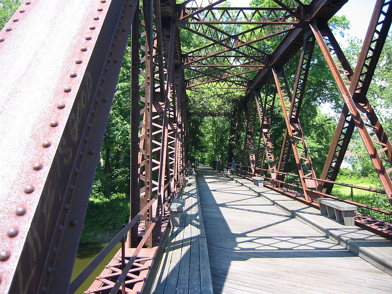
Wallkill Valley Rail Trail bridge north of New Paltz
Local lore5 min read The land that never lets go Sacred land, the Wallkill flats, and why the idea of a local curse has lasted for generations. Land and memoryOpen the full storyClose story
BlogNew Paltz › Local Lore
🌏 HV History · Local Lore

The Land That Never Lets Go

Leave New Paltz if you want. The ridge and river may still call you home.

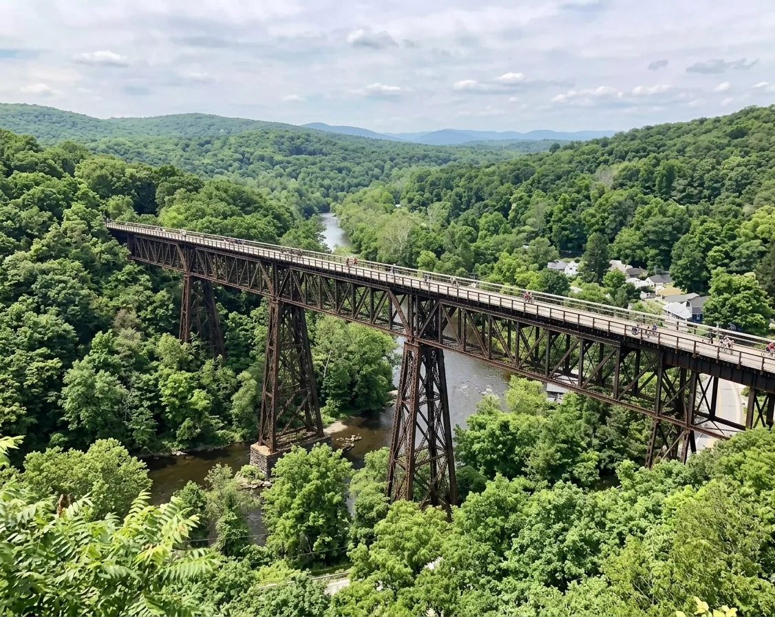
Wallkill Valley Rail Trail bridge north of New Paltz
Wallkill Valley Rail Trail bridge north of New Paltz · Public domain photo by Rock nj via Wikimedia Commons

There is a story people tell about New Paltz: live here long enough, or drink from the Wallkill in some versions, and you will always come back. You can leave for school, work, or an entirely different life. Years later, the ridge appears in a dream, the river shows up in a memory, and the Thruway starts pointing north again.

It is called a curse, but it is usually told with affection. The sources for this story do not document an Indigenous tradition placing a curse on New Paltz, so the legend should not be credited to the Esopus Munsee. The better story is about attachment, history, and a landscape that has held human attention for a very long time.

Start With the River

The Wallkill flows north for 88 miles before joining Rondout Creek. Along New Paltz, its floodplain created rich agricultural land known as the Flats. Esopus Munsee communities lived, farmed, hunted, gathered, and traveled throughout this valley for thousands of years. The river and ridge were not scenery around their lives. They were part of the structure of life itself.

European settlement changed that relationship. The 1677 agreement between Huguenot patentees and Esopus leaders helped establish New Paltz, while colonial expansion steadily displaced Native communities from their ancestral land. Descendants of the region's Munsee people live today in communities including the Stockbridge-Munsee Community in Wisconsin and Munsee-Delaware Nation in Ontario.

How a Local Legend Forms

New Paltz has a geography built for memory. The Shawangunk Ridge stays visible from roads, farms, campus paths, and Main Street. The Wallkill cuts through town. Huguenot Street keeps the colonial past physically present. SUNY New Paltz brings people here for a few years, and many discover that a few years can turn into a lifelong connection.

That combination helps explain the legend without pretending it came from a single ancient source. The so-called curse is a modern piece of local folklore, repeated because it describes something residents recognize: leaving New Paltz does not always feel like finishing with it.

The Place People Return To

The Flats remain among Ulster County's most productive agricultural lands. The River-to-Ridge Trail now links the village to protected land on the Shawangunk Ridge. The Wallkill Valley Rail Trail crosses the river just north of town. These routes let people experience the same relationship that drives the story: river below, ridge ahead, town in between.

Maybe the word curse survives because attachment is hard to explain without making it sound mystical. New Paltz gets into people. They leave. They return. The mountains stay exactly where they were.

Follow the Story
  • Wallkill Valley Rail Trail: Crosses the river north of New Paltz
  • River-to-Ridge Trail: Connects the village and the Shawangunk foothills
  • Historic context: Visit Historic Huguenot Street
Sources and further reading
  1. “Esopus People.” Wikipedia. en.wikipedia.org
  2. “Our Families / Community.” Historic Huguenot Street. huguenotstreet.org
  3. “River-to-Ridge Trail.” Open Space Institute. openspaceinstitute.org
  4. “Wallkill River.” Wikipedia. en.wikipedia.org
  5. “Wallkill River.” Town of Shawangunk, NY. shawangunk.gov
  6. “Discover the Hudson Valley's Native American History.” Hudson Valley Magazine, May 2023. hvmag.com
  7. “Curse of the Boulder Valley.” Wikipedia. en.wikipedia.org
  8. “Chief Niwot's Curse.” Boulder Weekly, December 2019. boulderweekly.com
  9. “New Paltz Regatta Returns to the Wallkill River.” Hudson Valley One. hudsonvalleyone.com
  10. The Enduring Spirit of New Paltz: Layers of History, Sacred Land, and a Persistent “Curse.” Source document provided.
↑ Back to top
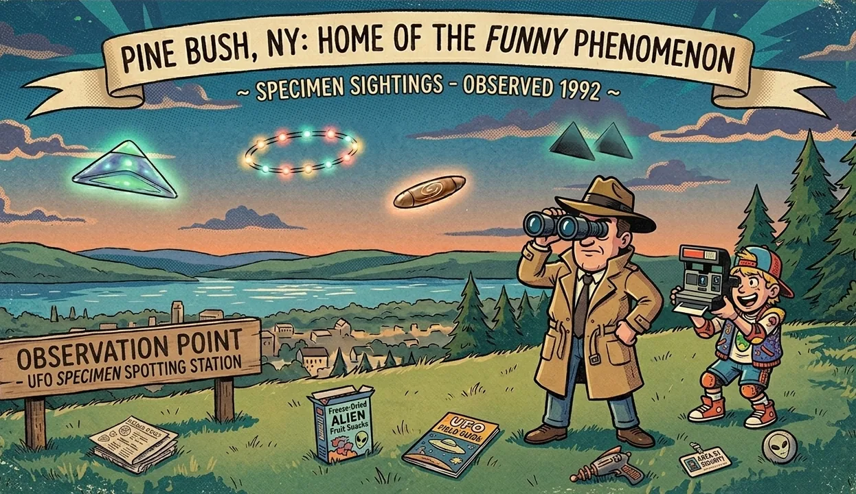
Night sky over Pine Bush
High strangeness6 min read Strange skies over Pine Bush Thousands of sightings, national attention, and one Hudson Valley town that decided to own the mystery. 1983 to 1986Open the full storyClose story
BlogPine Bush › Local Lore
🌌 Local Lore · Hudson Valley History

Strange Skies Over Pine Bush

A Hudson Valley town looked up, saw something strange, and made the mystery part of its identity.

Pine Bush NY
Pine Bush, Orange County, NY · “UFO Capital of the East Coast”

For a few years in the 1980s, people across the Hudson Valley kept looking up. They described enormous arrangements of white, red, and green lights moving slowly and almost silently through the night. Some saw a V. Others saw a boomerang. Many were ordinary residents who had not gone outside expecting a mystery.

Pine Bush became the town most closely connected with those reports. It now calls itself the UFO Capital of the East Coast, a title built from years of reported sightings, national attention, investigation, and a community that eventually decided the strange story belonged to it.

The Hudson Valley Flap

The peak period ran roughly from 1983 through 1986. Published accounts describe thousands of reports across the broader region, including Westchester, Putnam, Dutchess, Orange, and nearby Connecticut. Witnesses often described something very large, very low, and unusually quiet.

There was a practical explanation for at least some sightings. Pilots from Stormville Airport acknowledged flying small planes in tight formation at night. Their navigation lights could make separate aircraft look like one enormous object, especially from a distance. That explanation fits many reports, but witnesses and investigators argued that it did not fit every account.

One of the most dramatic stories involved Indian Point nuclear plant. Contemporary accounts said security personnel reported a large object over the facility in 1986. Details have been repeated and disputed for years, so the incident is better treated as part of the documented folklore around the flap, not as settled proof of what was in the sky.

Why People Took It Seriously

Astronomer J. Allen Hynek, once a scientific adviser to the Air Force's Project Blue Book, studied the Hudson Valley reports with investigator Philip Imbrogno. Their book Night Siege collected witness accounts and helped turn a regional mystery into a nationally known case.

Nearby, writer Whitley Strieber published Communion in 1987 after describing an encounter at his cabin in Accord. The book became a bestseller, and its cover helped define the popular image of the grey alien. Strieber avoided a simple extraterrestrial conclusion, calling the beings in his account only visitors.

The Town That Kept the Mystery

Pine Bush could have treated the attention as an embarrassment. Instead, it built a local identity around curiosity. The annual UFO Fair brings costumes, speakers, vendors, and families to Main Street. The Pine Bush UFO and Paranormal Museum collects timelines, witness accounts, and local research.

That balance is what keeps the story interesting. Some lights were almost certainly airplanes. Some reports remain difficult to reconstruct decades later. The evidence does not require a final answer to make Pine Bush worth visiting. The mystery is now part of the town's history, and the town tells it with equal parts seriousness and fun.

Visit Pine Bush
  • Museum: Pine Bush UFO and Paranormal Museum, Main Street
  • Annual event: Pine Bush UFO Fair
  • Current details: Check pinebushmuseum.com
Sources and further reading
  1. “The Pine Bush UFO and Paranormal Museum.” Wonderful Museums, September 2025. wonderfulmuseums.com
  2. “Hamlet of Pine Bush: UFO Capital of the East Coast.” Haunted History Trail of New York State. hauntedhistorytrail.com
  3. “The Hudson Valley UFOs: How the Media Reacted to a 1980s UFO Flap.” The Debrief, November 2023. thedebrief.org
  4. “Hudson Valley Community Drawing Attention for History of UFO Sightings.” Daily Voice, May 2021. dailyvoice.com
  5. Pine Bush UFO & Paranormal Museum official site. pinebushmuseum.com
  6. “UFO Fair Lands Again in Pine Bush.” Hudson Valley One, May 2019. hudsonvalleyone.com
  7. Strieber, Whitley. Communion: A True Story. Beech Tree Books, 1987.
  8. “Whitley Strieber.” Wikipedia. en.wikipedia.org
  9. “The Hudson Valley UFO Phenomenon.” Hudson Valley Corvette Club. thehudsonvalleycorvetteclub.com (page no longer online)
  10. The Enigmatic Skies and Earth of Pine Bush, New York. Source document provided.
↑ Back to top
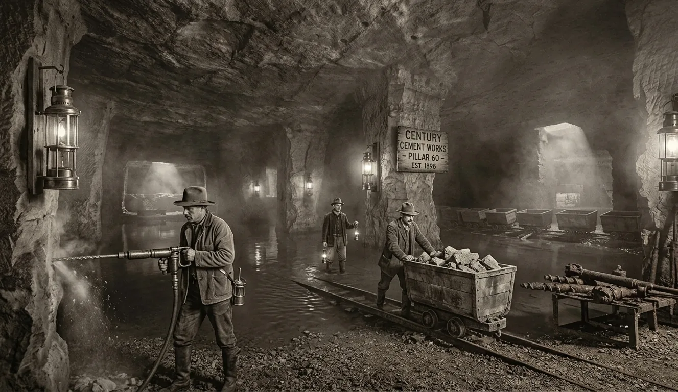
Rosendale cement mine
Industry7 min read The rock that built a nation The unlikely black rock beneath Rosendale that helped hold together landmarks across the country. Black rock, big legacyOpen the full storyClose story
BlogRosendale › HV History
🧱 Town Spotlight · HV History

The Rock That Built a Nation

The unlikely black rock under Rosendale helped hold together landmarks across America.

Rosendale Cement Mine, Ulster County NY
Rosendale Cement Mine · Ulster County, NY · Natural Cement Historic District

Walk across the Brooklyn Bridge and Rosendale is under your feet. Stand beside the Statue of Liberty's pedestal and Rosendale is holding it up. The same natural cement was used in major canals, fortifications, public buildings, and water systems across the country.

That is hard to imagine when driving through Rosendale today. The town feels small, creative, and slightly tucked away. In the 1800s, it was one of the most important industrial districts in North America.

The Rock the Canal Needed

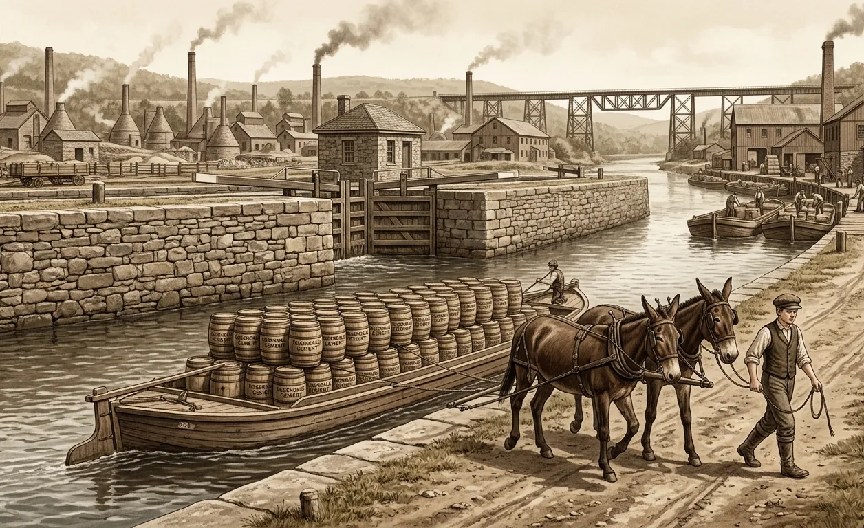
The story began during construction of the Delaware and Hudson Canal in the 1820s. Its locks and aqueducts needed hydraulic cement, a mortar that could harden underwater. Surveyors found an abundant clay-rich dolostone in the hills around Rosendale that produced exactly that material when burned and ground.

The canal used the local cement and also gave the new industry a route to market. Farms became mines and mills. Investors arrived. By the late 1800s, the Rosendale district had become one of North America's most important natural-cement producers.

A Town Working Underground

Thousands of people worked in the mines, kilns, mills, and transportation network. Many were Irish and German immigrants. The labor was dangerous and physically punishing. Room-and-pillar mining left great chambers underground, with columns of stone supporting the ceiling. Historical records also document child labor in parts of the industry.

What Rosendale Cement Helped Build
  • Brooklyn Bridge towers and foundations
  • Statue of Liberty pedestal
  • Croton Aqueduct structures and High Bridge
  • Fort Sumter and other coastal fortifications
  • Major public buildings including portions of the U.S. Capitol

The Widow Jane Mine

The best-known surviving mine is the Widow Jane on the Snyder Estate. Its broad chambers, stone pillars, dark water, and constant cool temperature feel almost architectural. After mining ended, the space found a surprising second life as a venue for concerts, poetry, recordings, art, and community events.

The mine carries both beauty and labor history. Its acoustics are extraordinary, but the chambers exist because generations of workers removed the rock that helped build the country. The Century House Historical Society keeps both sides of that story visible.

Why the Industry Faded

Portland cement eventually replaced natural cement because it set faster and could be manufactured with greater consistency. Most Rosendale operations closed by the early 1900s. The last major producer shut down in 1970, leaving mines, kilns, rail corridors, and company sites throughout the town.

Those remains helped shape modern Rosendale. Old railroad infrastructure became trail. Mines became storage spaces, performance spaces, and historical sites. Artists and musicians moved into a landscape built by an industry that had disappeared.

The Quiet Comeback

Natural cement returned because preservation specialists discovered that modern Portland cement can be too rigid for old masonry. Historic brick and stone need a mortar that can breathe and move. Rosendale natural cement is again produced for restoration work, including structures originally built with the same material.

The comeback is perfectly Rosendale: the old rock is useful again, not because the past returned unchanged, but because people finally understood what the original material did well.

Walk the History
  • Widow Jane Mine and Century House: Snyder Estate, Route 213
  • Pair it with: Rosendale Trestle and Wallkill Valley Rail Trail
  • Current events and access: Check centuryhouse.org
Sources and further reading
  1. “Rosendale Cement.” Wikipedia. en.wikipedia.org
  2. “On the Discovery of Rosendale Cement.” D&H Canal Historical Society. canalmuseum.org
  3. “The Valley's World-Beating Natural Cement Industry.” Scenic Hudson. scenichudson.org
  4. “A History of Rosendale's Natural Cement Industry.” Hudson Valley Magazine. hvmag.com
  5. “Widow Jane Mine.” Wikipedia. en.wikipedia.org
  6. “Widow Jane Mine.” Atlas Obscura. atlasobscura.com
  7. “Stories: Cement.” Century House Historical Society. centuryhouse.org
  8. “Canvass White.” ASCE Notable Civil Engineers. asce.org
  9. Werner, Dietrich & Burmeister, Kurtis C. “An Overview of the History and Economic Geology of the Natural Cement Industry at Rosendale, Ulster County, New York.” Journal of ASTM International, 2007.
  10. “Exploring the Abandoned Widow Jane Mine in Rosendale, NY.” Uncovering New York. uncoveringnewyork.com
  11. The Bedrock of a Nation: The Rise, Fall, and Legacy of Rosendale Natural Cement. Source document provided.
↑ Back to top
Rosendale Trestle above Rondout Creek
Trails7 min read The bridge sold for one dollar America's highest railroad bridge, a near bungee platform, and one of the Valley's best second acts. $1 second actOpen the full storyClose story
BlogRosendale › HV History
🌉 Town Spotlight · HV History

The Bridge Sold for One Dollar

A railroad giant, a one-dollar sale, and one of the Hudson Valley's best second acts.

Rosendale Trestle Bridge
Rosendale Trestle · 940 ft long · 150 ft above Rondout Creek · Wallkill Valley Rail Trail

Halfway across the Rosendale Trestle, most people stop. Rondout Creek is 150 feet below. The Shawangunk Ridge stretches across the western horizon. Route 213 and the old Delaware and Hudson Canal corridor thread through the valley beneath the steel.

The bridge is 940 feet long and was the highest span bridge in the United States when it opened in 1872. It carried trains for more than a century, was sold for one dollar, nearly became a bungee-jumping platform, and finally reopened as one of the Hudson Valley's most memorable walks.

A Railroad Needed One Impossible Crossing

The Wallkill Valley Railroad connected Gardiner, New Paltz, Rosendale, and Kingston to larger freight networks. Rondout Creek created the hardest obstacle on the route: a steep valley cut through the same stone formation that powered Rosendale's cement industry.

The original bridge used wrought iron. As locomotives grew heavier, the King Bridge Company rebuilt it in steel in 1895 and 1896. New members were installed around the older structure so trains could keep moving during much of the work. The steel bridge that visitors see today grew around the first one.

The Bridge That Moved Cement

The trestle helped move Rosendale cement year-round. Canal boats were slow, seasonal, and limited by freezing weather. Rail service connected the mines and mills to a larger market. From the bridge today, three transportation eras are visible together: canal corridor, highway, and railroad.

940
Feet long
150
Feet high
$1
1986 sale
2013
Reopened

One Dollar and a Bungee Plan

Conrail closed the rail line in 1977. Tracks were removed, maintenance stopped, and the bridge entered a long period of decay. In 1986, Conrail sold it to local businessman John Rahl for one dollar.

Rahl added planking and guardrails to part of the span and proposed commercial bungee jumping. Courts stopped the plan over zoning issues. Another operator tried again years later. Meanwhile, locals and adventurous visitors kept finding their way onto the closed bridge for the view.

The Community Second Act

After Ulster County acquired the property in 2009, the Wallkill Valley Land Trust and Open Space Institute worked to make the trestle the missing link in a continuous trail. The restoration raised about $1.5 million from public grants, foundations, organizations, and more than 110 individual donors. Volunteers helped install the final walking deck.

On June 29, 2013, the Rosendale Brass Band led the first official pedestrians across. The reopening connected trail sections from Gardiner and New Paltz toward Kingston. The bridge now carries walkers, cyclists, runners, skiers, and people who simply want to stand in the middle and look.

Walking It

The approach is flat because it follows the former rail grade. The crossing itself takes only a few minutes, but the view slows everyone down. Below are the creek, Route 213, and traces of the canal. Around you are the steel members of a working railroad bridge that became public space instead of scrap.

Plan a Visit
  • Closest parking: Binnewater Road lot in Rosendale
  • Access: From the Wallkill Valley Rail Trail
  • Current conditions: Check Wallkill Valley Land Trust
Sources and further reading
  1. “Celebrating a Milestone Anniversary of the Wallkill Valley Rail Trail: the Opening of the Rosendale Trestle.” Wallkill Valley Land Trust, June 2024. wallkillvalleylt.org
  2. “A Celebration of the Rosendale Trestle.” Wallkill Valley Land Trust, 2020. wallkillvalleylt.org
  3. “Wallkill Valley Rail Trail.” Wikipedia. en.wikipedia.org
  4. “Wallkill Valley Rail Trail, New Paltz to South Kingston.” Empire State Trail. empiretrail.ny.gov
  5. “Open Space Institute and Wallkill Valley Land Trust Announce Completion of Wallkill Valley Rail Trail Improvements.” Open Space Institute, December 2020. openspaceinstitute.org
  6. “Rosendale Trestle and Wallkill Valley Rail Trail.” MidAtlantic Daytrips. midatlanticdaytrips.com
  7. “Wallkill Valley Rail Trail.” Wallkill Valley Land Trust. wallkillvalleylt.org
  8. The Iron Guardian of the Rondout: The History and Rebirth of the Rosendale Trestle. Source document provided.
↑ Back to top
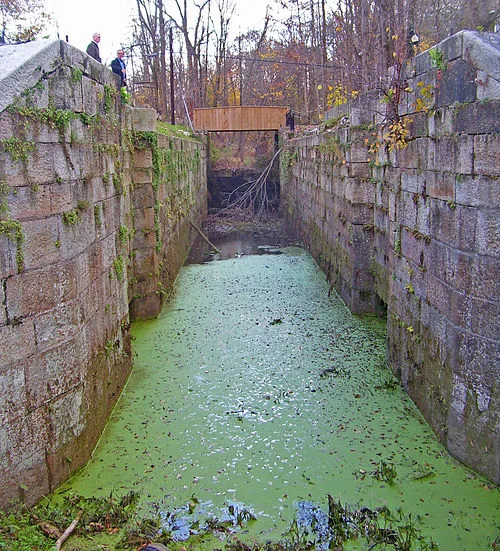
Historic lock on the Delaware and Hudson Canal
Canal history7 min read The hand-dug highway A 108-mile canal, 108 locks, and the accidental discovery that changed Rosendale forever. 108 locksOpen the full storyClose story
BlogHV History › High Falls
⛵ HV History · High Falls

The Hand-Dug Highway

A 108-mile water road, 108 locks, and the discovery that changed Rosendale.

D&H Canal lock at High Falls, NY
D&H Canal · 108 miles · 108 locks · 1828–1898 · National Historic Landmark

The Delaware and Hudson Canal carries one irresistible coincidence: it ran for 108 miles and used 108 locks. The rest of its history is just as unlikely. Thousands of workers dug it largely by hand over several years. It moved Pennsylvania coal to New York City, gave John Roebling an early proving ground, and helped create Rosendale's cement industry by accident.

New York Needed Heat

After the War of 1812 disrupted imported fuel, New York needed a reliable source of energy. Anthracite coal was abundant around Carbondale, Pennsylvania, but the mountains made it difficult to reach eastern markets. Brothers William and Maurice Wurts proposed a canal from Honesdale to the Hudson River at Rondout.

Construction ran from 1825 through 1829. About 2,500 laborers worked through difficult terrain, building locks, dams, bridges, reservoirs, and a four-foot-deep waterway. The canal eventually carried coal, cement, and other goods for seventy years.

A Water Road Through the Valley

From Rondout Creek, the canal followed the valley southwest through Rosendale, High Falls, Ellenville, Wurtsboro, and Port Jervis before crossing into Pennsylvania. Coal reached the canal by a gravity railroad from the mountains near Carbondale.

That railroad produced another milestone. On August 8, 1829, the English-built Stourbridge Lion became the first steam locomotive to run on commercial track in the United States. The track was too light for regular service, so the experiment ended quickly, but the moment remained part of American railroad history.

Rosendale D&H Canal historical photograph
Rosendale · D&H Canal historical photograph · Ulster County, New York

The Rosendale Discovery

Canal locks needed mortar that could harden underwater. During construction, surveyors found the right kind of cement rock in the hills near Rosendale. The canal used the local material, then carried the finished product to market as mines and mills grew around it.

The connection came full circle. John Roebling later designed suspension aqueducts for the canal and went on to design the Brooklyn Bridge, which used Rosendale cement discovered during the canal project.

Life at Three Miles an Hour

Canal boats moved slowly behind teams of mules. The person guiding the animals was called a hoggee, often a child who walked mile after mile in every kind of weather. Families lived aboard during the operating season. Lock tenders stayed ready to raise or lower water whenever a boat arrived.

At High Falls, grooves worn into stone record thousands of passages. Boatmen wrapped heavy ropes around snubbing posts to control a loaded barge as it entered a lock. Every groove marks years of friction, muscle, and repetition.

The Five Locks

Locks 16 through 20 are the canal's most visible remains in High Falls. Built from carefully fitted Shawangunk conglomerate, the five chambers raised or lowered boats a combined 63 feet. A short walk follows the former towpath past the surviving stonework.

Farther south, Roebling's Delaware Aqueduct at Minisink Ford survives as the oldest wire suspension bridge in the United States. It once carried canal water and floating boats over the Delaware River. Today it carries road traffic.

What Replaced the Canal

Railroads were faster, carried more, and did not freeze in winter. The canal closed in 1898, although sections continued serving Rosendale cement for years afterward. The company transformed into the Delaware and Hudson Railroad.

The canal's afterlife is easier to see on foot. Museums, lock ruins, towpaths, and unnaturally level grades trace a transportation system that once heated New York and reshaped the towns along its route.

Walk the Canal
  • D&H Canal Museum: Mohonk Road, High Falls
  • Five Locks Walk: Short towpath walk beside Locks 16 through 20
  • Current hours and tours: Check canalmuseum.org
Sources and further reading
  1. “Delaware and Hudson Canal.” Wikipedia. en.wikipedia.org
  2. “How the Delaware & Hudson Canal Fueled the Hudson Valley.” Hudson Valley Magazine. hvmag.com
  3. “History: The D&H Canal.” VISITvortex. visitvortex.com
  4. “D&H Canal Lock Stone in High Falls.” D&H Canal Historical Society. canalmuseum.org
  5. “Five Locks Walk.” D&H Canal Historical Society. canalmuseum.org
  6. “D&H Canal Historical Society and Museum.” Hudson River Valley Heritage Area. hudsonrivervalley.com
  7. “Five Locks Walk: Learning About the D&H Canal in High Falls, NY.” MidAtlantic Daytrips. midatlanticdaytrips.com
  8. “Delaware & Hudson Canal Interpretive Center and Linear Park.” Sullivan County NY. sullivanny.gov
  9. “History of the D&H.” Delaware & Hudson Railway Historical Society. delawarehudson.org
  10. “Delaware and Hudson Gravity Railroad.” Wikipedia. en.wikipedia.org
  11. The Coal-Fueled Highway: The Rise, Fall, and Legacy of the D&H Canal. Source document provided.
↑ Back to top
Walkway Over the Hudson from above
Engineering6 min read The bridge that refused to die A world-record railroad bridge, a devastating fire, and a comeback that reunited both riverbanks. 1.28 milesOpen the full storyClose story
BlogPoughkeepsie / Highland › HV History
🏗️ HV History · Engineering

The Bridge That Refused to Die

A world-record railroad bridge burned, sat abandoned, and came back carrying walkers.

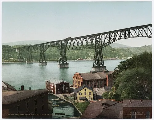
Poughkeepsie Railroad Bridge, historical photograph
Detroit Photographic Company · Poughkeepsie Railroad Bridge · circa early 1900s

The Poughkeepsie Railroad Bridge opened in 1888 as the longest bridge in the world. It moved freight and troops, survived changing railroads, burned in 1974, sat abandoned for decades, sold for one dollar, and reopened as the Walkway Over the Hudson.

Its second life feels inevitable now. For years, it looked nearly impossible.

The Crossing the Railroads Wanted

For most of the 1800s, freight traveling between New England and points west had no fixed Hudson River crossing south of Albany. Rail cars were ferried across the water or sent far north. Poughkeepsie's high riverbanks made a bridge possible without blocking ship traffic.

The idea appeared in a local newspaper in 1868, but financing delays and the Panic of 1873 repeatedly stalled construction. Work finally accelerated in 1886. The first train crossed on December 29, 1888, and formal service began days later.

A Working Giant

The bridge connected coal fields and western industry with New England markets. Engineers strengthened it in 1907 as freight trains became heavier. During World War II, as many as 3,500 rail cars crossed daily according to historical accounts.

By the 1970s, traffic and maintenance had collapsed. Penn Central had eliminated bridge watchmen and allowed its fire-suppression water line to fail. On May 8, 1974, a fire, likely sparked by a train, burned about 700 feet of decking and supporting material.

The Fire That Ended the Railroad

Officials initially predicted repairs. They never happened. The bridge stood empty above the Hudson while ownership, liability, and demolition proposals moved from one organization to another. In 1984, Conrail sold the structure and miles of right-of-way for one dollar.

Plans ranged from a highway to a shopping destination. A small group of advocates kept returning to a simpler idea: let people walk across it.

The Long Road Back

The nonprofit Walkway Over the Hudson took ownership in 1998. Supporters raised money, secured grants, and brought politicians and business leaders onto the bridge so the view could make the argument. Workers repaired steel high above the river through all seasons.

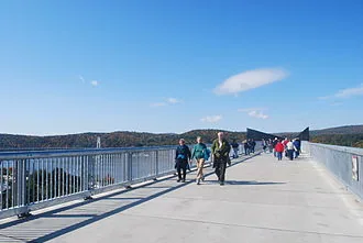
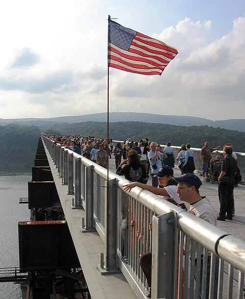
On October 3, 2009, the Walkway Over the Hudson State Historic Park opened. The new deck linked the Hudson Valley Rail Trail in Highland with the Dutchess Rail Trail in Poughkeepsie. What had divided two trail systems became their most dramatic connection.

People walking across Walkway Over the Hudson
Walkway Over the Hudson · 212 feet above the river · Poughkeepsie to Highland
1.28
Miles long
212
Feet high
$1
Sale price
2009
Reopened

Today the bridge is a public overlook, trail connection, gathering place, and reminder that infrastructure can have more than one useful life. The river views are enormous, but the best part of the story is underfoot: 19th-century steel carrying a 21st-century crowd.

Plan a Walk
  • Access: Entrances in Highland and Poughkeepsie
  • Connections: Hudson Valley Rail Trail, Dutchess Rail Trail, Empire State Trail
  • Current hours and events: Check walkway.org
Sources and further reading
  1. Walkway Over the Hudson. “Our Story.” walkway.org
  2. Wikipedia. “Walkway over the Hudson.” en.wikipedia.org
  3. Hudson River Valley Institute. “Walkway Over the Hudson.” hudsonrivervalley.org
  4. Hudson River Valley Institute. “Poughkeepsie Railroad Bridge.” hudsonrivervalley.org
  5. NYS Parks. “Walkway Over the Hudson State Historic Park.” parks.ny.gov
  6. HV Mag. “Walkway Over the Hudson: A History.” hvmag.com
  7. Mabee, Carleton. Bridging the Hudson: The Poughkeepsie Railroad Bridge and Its Connecting Rail Lines. Purple Mountain Press, 2001.
↑ Back to top
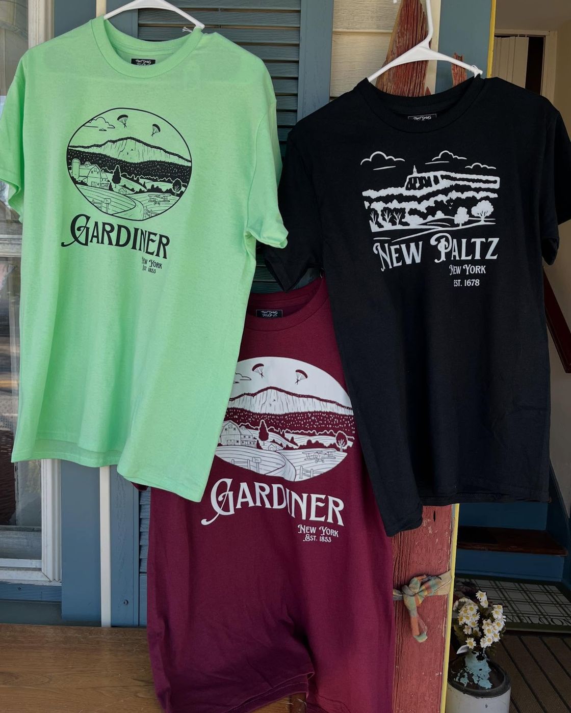
Gardiner shirts hanging at This Little Light of Mine
Shop story4 min read Where the retail story began A conversation, a parachuter design, and the first shop to make That Dawg Local part of its town. First retail partnerOpen the full storyClose story
BlogGardiner › Local Business
🪂 Local Business · Behind the Designs

Where the Retail Story Began

A conversation, a parachuter design, and the first shop to make That Dawg Local part of its town.

Gardiner shirts hanging at This Little Light of Mine
Gardiner tees at This Little Light of Mine · Approved That Dawg retailer photography

When I first started building That Dawg Design Co. and sharing that with my local retailer friends in New Paltz, they expressed a need for a nicer design that represents the local area and can cater to the tourists and local pride. That is how I started designing That Dawg Local designs.

When I made my first Gardiner design, Ingrid at This Little Light of Mine Candle Shop asked me to add the parachuters, which absolutely made sense and truly made the design.

Why the Parachuters

Gardiner is known for Skydive the Ranch, established in 1983. I personally used to spend a lot of time with some of the instructors there in my late teens, so I am very familiar with what that place means to the town. It felt like the iconic scene of Gardiner, and with the silhouette of the Shawangunk ridgeline below, it was perfection. Two parachuters descending together over those fields, that view is something you recognize immediately if you know Gardiner.

The Partnership

This Little Light of Mine officially moved their shop from New Paltz to Gardiner in the spring of 2026 and became the perfect partnership for That Dawg Local. We are so proud to partner with someone who makes her goods completely by hand and is a true lover of dogs. Her handmade candles will also be joining the That Dawg Local product lineup soon, so stay tuned.

How the District Model Works

The exclusivity is district-based, not town-wide. A shop in New Paltz could carry the Gardiner parachuter shirt if they wanted to. What they cannot do is carry the New Paltz design if that district is already claimed. No one else in This Little Light of Mine's shopping district gets to carry the Gardiner design as long as she holds that spot. It protects the retailer in their own backyard without locking the designs out of the rest of the valley.

Retailer Spotlight
  • Store: This Little Light of Mine
  • Address: 2260 Route 44/55, Gardiner, NY 12525
  • What they make: Handmade candles and curated goods
  • District: Gardiner, Ulster County (exclusive)
  • Design: The Parachuters, No. 1
  • Territory status: Closed

What's Next

Gardiner is closed. The line keeps moving: New Paltz, Rosendale, Highland, Poughkeepsie, Newburgh. Each town gets its own design, its own story, its own retailer. If you have a shop in one of those towns and you want to talk about being first in your district, reach out before someone else does.

Story notes

This shop story comes from Rachel's first-hand account of creating the Gardiner design with Ingrid at This Little Light of Mine.

↑ Back to top
Apple orchard in the Highland and Marlboro fruit-growing corridor
Town spotlight5 min read The apple capital hiding in plain sight River climate, glacial soil, deep farming roots, and the orchards still shaping Highland today. 30+ apple varietiesOpen the full storyClose story
BlogHighland › Town Spotlight
🍎 Town Spotlight · Highland, NY

The Apple Capital Hiding in Plain Sight

The orchards make more sense when you know what the river, soil, railroads, and farm families built together.

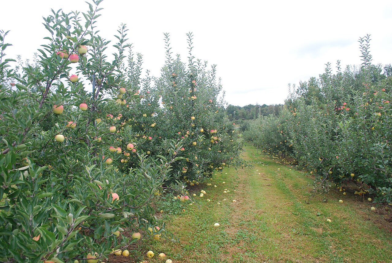
Apple orchard in the Highland and Marlboro fruit-growing corridor
Apple orchard in nearby Marlboro, part of the same Ulster County fruit corridor · Public domain photo by Juliancolton via Wikimedia Commons

Every fall, people arrive in Highland for apples, cider, hayrides, and the promise of one perfect cider donut. The orchards can feel like a seasonal tradition that has always been there. In reality, the region became apple country through a rare combination of river climate, glacial soil, transportation, and families willing to keep farming.

The River Protects the Fruit

The Hudson River acts as a climate buffer. Water warms and cools more slowly than land, softening some temperature swings along the river corridor. For orchards, that can mean a longer autumn growing season and fewer damaging spring temperature changes.

The land adds another advantage. Glaciers left mineral-rich soils, while sloping ground helps water and cold air drain away from tree roots and blossoms. Farmers did not design that geography. Generations learned how to work with it.

Apples Became an Industry

European settlers brought cultivated apples into the Hudson Valley during the colonial period. By the 1800s, fruit was a major regional product. Highland's Farmers' Turnpike, now the Milton Turnpike, was commissioned in 1790 in part to move fruit and cider toward river docks.

The Poughkeepsie Railroad Bridge changed the market again when it opened in 1888. Fruit from the west side of the Hudson could reach New England and other eastern markets more quickly. A bridge built for freight helped turn a strong local farming district into a wider distribution hub.

The Families Still Farming

The story is visible in farms that adapted instead of disappearing. Wilklow Orchards has remained in the same family for six generations. DuBois Farms revived land that had been headed toward development and built a pick-your-own destination around orchards, vineyards, food, and drink. Prospect Hill Orchards in nearby Milton has also stayed in family agriculture across generations.

Agritourism keeps these farms economically active, but the hayrides are only the newest layer. Underneath are climate knowledge, pruning, soil care, harvest labor, transportation history, and family decisions made year after year.

1790
Farmers' Turnpike
1888
Rail bridge opens
6
Wilklow generations
30+
Local varieties

More Than Apple Picking

When you pick an apple in Highland, you are holding several stories at once: a river that moderates the weather, soil left by glaciers, roads and rails that opened markets, and a family that kept the land in production.

The donut is still worth getting. The apple tastes better when you know why it grew here.

Find the Orchard Story
  • Highland and Milton: Several family farms offer seasonal pick-your-own
  • Before visiting: Check each farm directly for crop availability and current hours
  • Pair it with: A walk across the Highland side of Walkway Over the Hudson
Sources and further reading
  1. “How the Hudson Valley Became a Land of Orchards.” Hudson Valley One, Oct. 2023. hudsonvalleyone.com
  2. “History of Fruit Growing in the Hudson Valley.” Cornell University Jentsch Lab. blogs.cornell.edu
  3. Wilklow Orchards. wilkloworchards.com
  4. DuBois Farms. duboisfarms.com
  5. “Walkway Over the Hudson: A History.” HV Mag. hvmag.com
↑ Back to top
From story to shop

Carry the town people already love.

That Dawg Local turns town history, landmarks, and hometown pride into apparel and gifts made for Hudson Valley retailers. Read the story, find the design, and bring your town into the shop.

Browse the wholesale demo Retailer portal The demo shows the catalog without pricing. Approved retailers use the portal for ordering.